THE PLATFORM FAMILY

A platform for every perspective.

From drone-like scale to a swarm-deploying mothership: one modular approach to persistent, AI-enabled Earth observation.

Micro platform lighter-than-air observation platform01 / PLATFORM FAMILY
COMPACT & CLOSE-RANGE

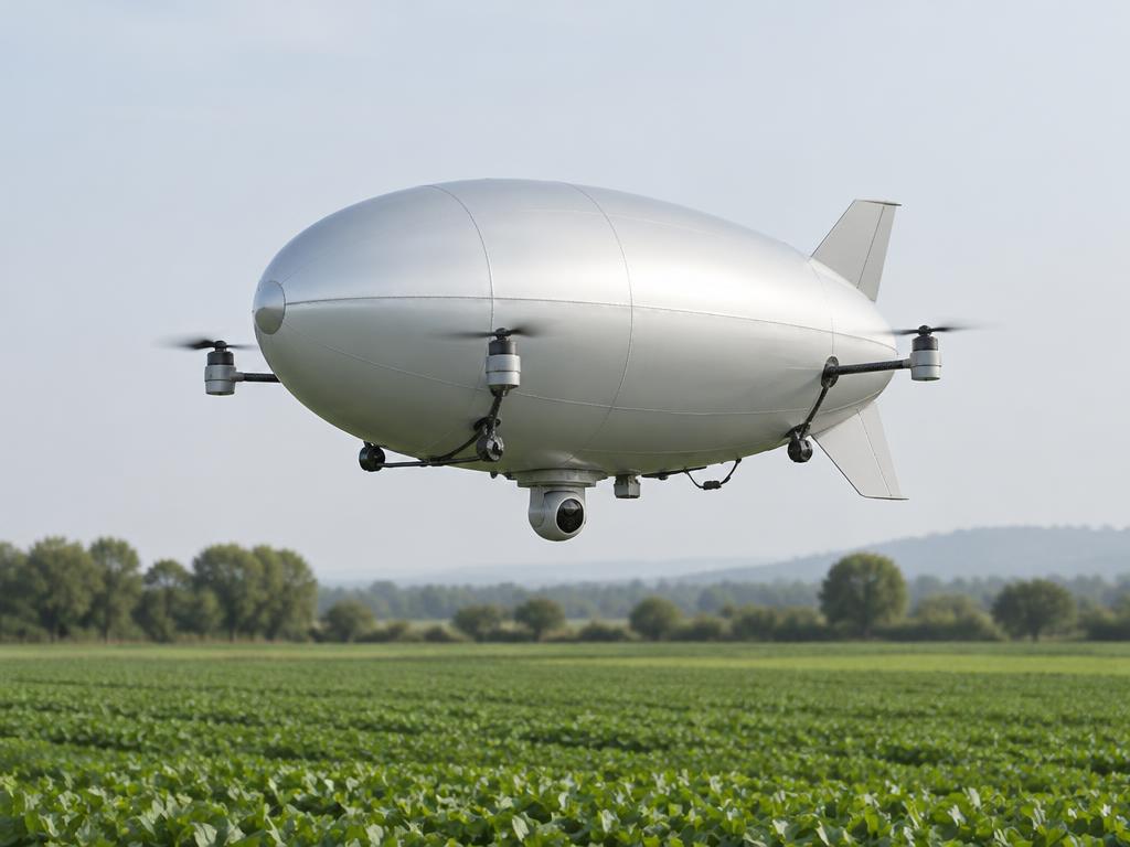
Micro platform

Drone-scale lighter-than-air sensing for precise, local observation with a small operational footprint.

Operation
Tethered / untethered
Mission
Local observation
Payload options
Compact EO/IR · environmental sensors
Configure a mission
Mission platform lighter-than-air observation platform02 / PLATFORM FAMILY
PERSISTENT & ADAPTABLE

Mission platform

A modular aerial vantage point for regional mapping, infrastructure monitoring, and mission-specific sensing.

Operation
Tethered / untethered
Mission
Regional observation
Payload options
LiDAR · multispectral · stabilised EO/IR
Configure a mission
Mothership platform lighter-than-air observation platform03 / PLATFORM FAMILY
WIDE-AREA & DISTRIBUTED

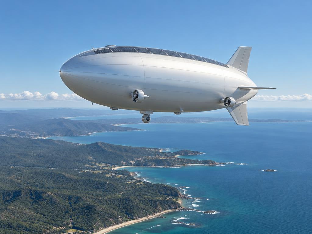
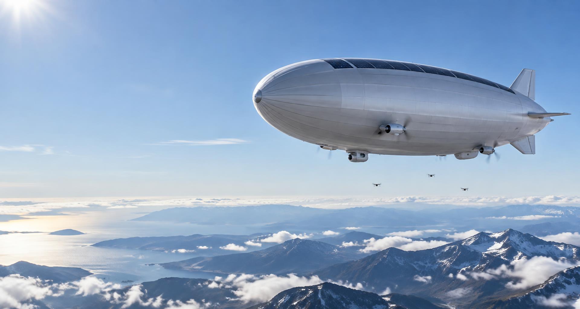
Mothership platform

A large-scale pseudo-satellite combining wide-area sensing with deployable drone swarms.

Operation
Untethered / mission-dependent
Mission
Wide-area & swarm missions
Payload options
Multi-sensor suite · drone deployment
Configure a mission
MISSION REELS

See each platform at work.

Typical missions for each tier: the platform on station, its drone swarm deployed, and the ground assets that launch, charge and relay.

AGL 80 mTETHEREDSCOUTS 2GROUND: MOBILE CCTV + WINCH

Micro · tethered port perimeter watch

Compact tethered aerostat on a winch trailer, powered and linked through the tether from a mobile CCTV command vehicle, directing two dock-launched scout quadcopters along the fence line.

Each reel shows a mission-specific build of the same platform class: propulsor count and layout, payload pods, solar-film coverage and hull finish are selected per mission in the configurator.

More mission profiles

MISSION PLATFORM

Forests & biodiversity

Canopy structure, habitat connectivity and clearing benefit from repeated measurements combining airborne surveys, satellite products and ground observations.

300–1 500 m AGL · Campaign corridor defined by sensor reach and survey overlap · Weekly patrol sweeps, quarterly full-campaign LiDAR

  • Lightweight LiDAR for canopy height and understorey structure
  • Multispectral imager for species and health signatures
  • EO zoom camera for verification of detected anomalies
  • Edge change-detection comparing each sweep against the baseline
Test this mission
MISSION PLATFORM

Climate & atmospheric science

Atmospheric profiling needs sustained, repeated measurements through the boundary layer and above — precisely where weather balloons pass through in minutes and satellites sample coarsely.

500 m–8 km (mission-profiled) · Vertical columns and transects over the study area · Continuous profiling for the campaign duration

  • Atmospheric sensor suite (temperature, humidity, pressure, particulates)
  • Greenhouse-gas analyser for CH₄/CO₂ column measurement
  • Hyperspectral imager for surface-atmosphere studies
  • Scientific data bus for investigator-provided instruments
Test this mission
MICRO PLATFORM

Port & harbour operations

Approach channels, anchorages, and terminals need continuous safety oversight — berth scheduling, incident response, and security — in an environment where every minute of delay costs money.

100–500 m AGL tethered mast-station · Full port complex and approaches · Duty cycle established through weather, maintenance and mooring validation

  • EO/IR gimbal with thermal night capability
  • AIS receiver integrated with the port VTS picture
  • Fibre tether feeding the port operations centre directly
  • Heave-compensated vessel-mooring option for offshore terminals
Test this mission
MISSION PLATFORM

Urban air quality & heat resilience

Air quality and urban heat vary street by street, yet monitoring networks sample from a handful of fixed stations — leaving exposure inequities and heat-island effects unmeasured where people actually live.

100–800 m AGL over the urban grid · Full metropolitan transects per sweep · Daily transects; intensive campaigns during heat episodes

  • Particulate and gas analyser suite (PM2.5, NO₂, O₃)
  • Thermal imager mapping surface-temperature islands
  • Hyperspectral option for vegetation and surface characterisation
  • Transect-repeating navigation for comparable day-to-day profiles
Test this mission
MISSION PLATFORM

Mapping & public research

National mapping, archaeology, and academic campaigns need a stable sensor platform that flies precisely repeatable lines for days — without the cost of crewed photogrammetric aircraft.

300–3 000 m AGL (mission-profiled) · Region-scale blocks on fixed, repeatable flight lines · Campaign-based, seasonally repeatable

  • Large-format photogrammetric camera or survey LiDAR
  • Custom instrument bus for scientific payloads
  • PPK-grade navigation for repeatable acquisition geometry
  • Raw-data delivery with full capture metadata
Test this mission
JOINT THEATRE

Every tier. One network.

All platform tiers, daughter UAV swarms, ground and maritime assets operating together, with an optional satellite layer: orbital reach-back, SATCOM backhaul, mesh relay and tether fibre carrying one shared picture to the command vehicle.

SPACE SEGMENT · OPTIONAL ORBITAL LAYERStratospheric low-wind layer · minimal station-keeping powerEO/IR footprintSAR swathPersistent ISRLAND · GROUND SEGMENTSEA · MARITIME SEGMENT20 km10 km2 km300 mSatellite (optional)Mothership XLMothershipMission (tethered)Mission (free-flying)Micro (tethered)Micro (free-flying)Micro (ship-tethered)Micro (ship-tethered)Command vehicleWinch trailerHeHelium tube trailerAI CCTV mastOff-grid stationWireless charging padsBorder checkpointOffshore wind farmSupport vessel APatrol vessel B
MISSION SIZING CONSOLE

Size the mission yourself.

Set an operating altitude and payload mass. The console applies the standard-atmosphere buoyancy relation and returns a payload-only lift-volume starting point and geometric horizons; full-system sizing follows in the mission dashboard.

AIR DENSITY (ISA)1.058 kg/m³86% of sea level
REQUIRED ENVELOPE55 m³helium, incl. 25% structure allowance
OPTICAL HORIZON138 kmradar horizon 160 km
PEAK IRRADIANCE966 W/m²solar-electric collection potential
PLATFORM CLASSMicro platformmatched from the platform family

First-order ISA buoyancy model: net helium lift ≈ 0.862 × local air density per cubic metre, plus a 25% envelope and ballonet allowance. Horizon distances use the standard optical (3.57√h) and 4/3-Earth radar (4.12√h) approximations. Final sizing is confirmed through mission engineering.

Fly your configuration in the live test dashboard
ENGINEERING SPECIFICATIONS & ATMOSPHERIC DATALift physics, sizing correlation, operating architectures, solar-electric power and altitude strategyOpen specifications
THE SCIENCE OF LIFT

Sized by physics.
Matched to the mission.

Lighter-than-air platforms obey a simple, unforgiving equation: lift comes from displaced air. Envelope volume, payload, and altitude are therefore locked together — and understanding that relationship is where every mission begins.

GOVERNING PHYSICSF_net = [V · (ρ_air − ρ_gas) − m_system] · g

Net buoyant lift = displaced air mass − lifting gas mass − structure. Volume, not area, is the currency of lighter-than-air flight.

Buoyant lift

Archimedes’ principle: net lift equals the weight of displaced air minus the lifting gas and structure. At sea level (ISA, 15 °C), helium provides ≈ 1.06 kg of net lift per cubic metre; hydrogen ≈ 1.14 kg/m³.

Altitude penalty

Air density falls exponentially with altitude. At 5 km it is ≈ 60% of sea level; at 20 km only ≈ 7%. An envelope lifting 100 kg at sea level lifts roughly 7 kg at 20 km — stratospheric operation demands very large volume per kilogram of payload.

Superpressure & ballonets

Day–night thermal cycles change gas temperature and lift. Air ballonets or superpressure envelopes manage volume and pressure, at the cost of additional mass and blower power.

Tether advantage

A tethered platform trades altitude for persistence: power and data travel up the tether, reducing onboard energy-storage demand. Availability depends on ground supply, tether loads, weather limits, gas servicing and maintenance.

PAYLOAD × ENVELOPE × ALTITUDE

The sizing correlation.

First-order engineering relationships between platform class, envelope volume, payload capacity, and operating altitude under standard atmospheric conditions.

Platform classEnvelopeVolumePayloadOperating altitudeEnduranceTypical fit
Micro platformSized from validated hull geometry10–60 m³1–8 kg50–300 m AGLConfiguration-specificCompact sensors; crew and ground-handling needs set per site
Mission platformSized from validated hull geometry400–4 000 m³20–150 kg300–3 000 m AGLConfiguration-specificLiDAR + multispectral + stabilised EO/IR; regional persistence
Mothership platformHigh-altitude development study30 000–250 000 m³150–1 000+ kg15–25 km (stratosphere)Requires flight validationMass, propulsion and envelope validation required; airborne drone deployment not qualified
Full altitude range · ISA density and helium envelope required per 100 kg of lifted mass (net lift 0.862ρ, +25% structure allowance)
AltitudeAir density% sea levelEnvelope / 100 kgOptical horizonPlatform class
100 m1.213 kg/m³99%120 m³36 kmMicro
300 m1.190 kg/m³97%122 m³62 kmMicro
1,000 m1.112 kg/m³91%130 m³113 kmMission
3,000 m0.909 kg/m³74%160 m³196 kmMission
5,000 m0.736 kg/m³60%197 m³252 kmMission (high-altitude variant) / transit
8,000 m0.525 kg/m³43%276 m³319 kmMission (high-altitude variant) / transit
12,000 m0.311 kg/m³25%467 m³391 kmMission (high-altitude variant) / transit
15,000 m0.194 kg/m³16%749 m³437 kmMothership
20,000 m0.088 kg/m³7%1,647 m³505 kmMothership
25,000 m0.039 kg/m³3%3,676 m³564 kmMothership
OPERATING ARCHITECTURES

Tethered, free-flying, ship-borne, or swarm.

Four ways to hold a position in the sky. Each architecture trades endurance, mobility, and infrastructure differently — select one to compare.

Ground-anchored power and fibre architecture. Availability depends on tether rating, ground power, weather, gas servicing and maintenance.

AltitudeSite and tether dependent
EnduranceValidated service interval
PowerRated conductors and converters
DataQualified fibre transceivers

Tethered operation

Site- and tether-specific · Ground-supply and weather limited

Rated conductors, conversion losses, backup storage and winch loads require joint sizing. Fibre link capacity depends on qualified transceivers and tether integration; RF jamming does not affect the fibre path.

Fixed station; tether mass, aviation limits, storms, servicing and ground handling constrain availability.

Untethered operation

Vehicle-specific validated envelope · Mission energy budget required

Battery, solar or hybrid choices require complete mass and energy accounting. RF, satellite or stored data chosen against link budget, spectrum and terminal constraints.

Cruise drag, wind, control authority and recovery reserves determine usable endurance.

SOLAR-ELECTRIC HARVESTING

Powered by the sky it flies in.

Envelope-integrated flexible photovoltaics turn the platform into its own power station — a candidate source of daytime energy, subject to the full mission energy balance.

Solar resource

Available irradiance depends on latitude, season, solar angle, cloud cover and altitude. Cell temperature is not ambient temperature; use measured module temperature coefficients and a site-specific energy model.

Flexible photovoltaic modules

Flexible photovoltaic modules and lightweight arrays are commercially available. Verify the exact vendor module efficiency, laminate mass, bend radius, encapsulation, cold/UV endurance and envelope bonding; cell-level figures are not installed-system figures.

The diurnal energy balance

E_collected ≥ E_day_load + E_night_load / η_roundtrip is a necessary energy condition, not a persistence guarantee. Include shading, seasonal daylight, battery pack mass, heating, degradation, reserve, converter losses and worst-case propulsion demand.

Endurance qualification

Solar can extend endurance only when daytime collection and usable night storage close the full mission budget. Months-long station keeping is not established for these platform families; gas leakage, weather and maintenance remain limiting.

ALTITUDE STRATEGY

Seven layers of perspective.

Low altitude · 50–300 m

Within the atmospheric boundary layer. Highest spatial resolution (centimetre-class GSD), minimal atmospheric path for thermal and multispectral sensing. Tethered operation is most efficient here.

Precision agriculture, infrastructure inspection, event safety, search & rescue

Medium altitude · 300–3 000 m

Above most terrain and obstacles; a single station covers a 30–80 km line-of-sight radius. Air density still supports useful lift per volume. Wind climatology and propulsion power must be evaluated per location.

Regional mapping, wildfire intelligence, utilities corridors, coastal observation

Upper mid-altitude · 3–5 km

Air density ≈ 74–60% of sea level, so envelope volume grows ~1.4–1.7× for the same lift. Geometric 4/3-Earth horizon is approximately 226–291 km to a sea-level receiver; this is not a radio coverage guarantee. Cloud, icing and turbulence become planning factors.

Wide-area mapping, border and maritime monitoring, disaster response coordination

Lower troposphere ceiling · 5–8 km

Density ≈ 60–43% of sea level (~1.7–2.3× volume). Temperatures fall to −17 to −37 °C, driving thermal control of batteries and electronics. Jet-stream fringes raise station-keeping power, so free-flight operations are seasonally planned.

Regional situational awareness, atmospheric science, communications relay

Upper troposphere · 8–12 km

Density ≈ 43–25% of sea level (~2.3–4× volume). This band shares airspace with commercial jet traffic and hosts peak jet-stream winds of 30–60 m/s, making it a transit layer rather than an operating station for most missions.

Ascent and descent transit, atmospheric profiling, short-duration sorties

Tropopause transition · 12–15 km

Density ≈ 25–16% of sea level (~4–6× volume). Temperature stabilises near −56 °C and winds vary with latitude and season; persistence cannot be assumed from altitude alone.

High-altitude test operations, wide-footprint sensing, relay staging

Stratosphere · 15–25 km

Airspace coordination remains necessary. ISA density falls from approximately 16% at 15 km to 3% at 25 km; the geometric horizon is not the sensor footprint or usable link range. Extreme UV, ozone, and −60 °C thermal cycling drive material and power design.

Wide-area situational awareness, communications relay, distributed swarm operations
YOUR MISSION. OUR NEXT FRONTIER.

Let’s see what’s possible.

Discuss a mission